Residents in Mountain Home and the Twin Lakes Area are facing one more day of triple-digit heat before much-needed rain and cooler temperatures arrive later this week. The National Weather Service (NWS) in Little Rock predicts a high of 100 degrees for Wednesday, with the heat driven by an upper-level ridge that has brought abnormally hot and dry conditions across Arkansas.
This upper-level ridge is expected to weaken by Thursday, creating an opportunity for rain and cooler weather. Northern Arkansas is currently expected to benefit most from the incoming rainfall, with precipitation and cloud cover anticipated to lower temperatures and reduce heat risks. Rain is forecast to persist periodically through Sunday, as a disturbance moves through the state and a frontal boundary stalls near the Arkansas-Missouri border.
Despite the temporary relief, forecasters caution that this cool-down is unlikely to signal a lasting fall weather pattern. The NWS forecast discussion suggests the upper-level ridge may rebuild next week, bringing drier and hotter conditions back to the region. Persistent drought conditions and wildfire threats compound the concern, even with rainfall expected over the next few days.
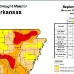
Arkansas has been under significant drought stress for much of 2026, according to the NWS, with recent scattered rains failing to provide substantial relief. The Climate Prediction Center has identified northern Arkansas as being at risk for rapid drought development between September 14 and 20. Nearly every county in the state, including all in northern Arkansas, remains under burn bans as declared by state officials, underscoring the high wildfire danger.
While the upcoming rainfall offers some short-term relief, the state’s extensive rainfall deficits mean that drought concerns will likely persist. Residents are urged to remain cautious with outdoor activities that could spark fires and to stay hydrated as triple-digit temperatures linger for another day.