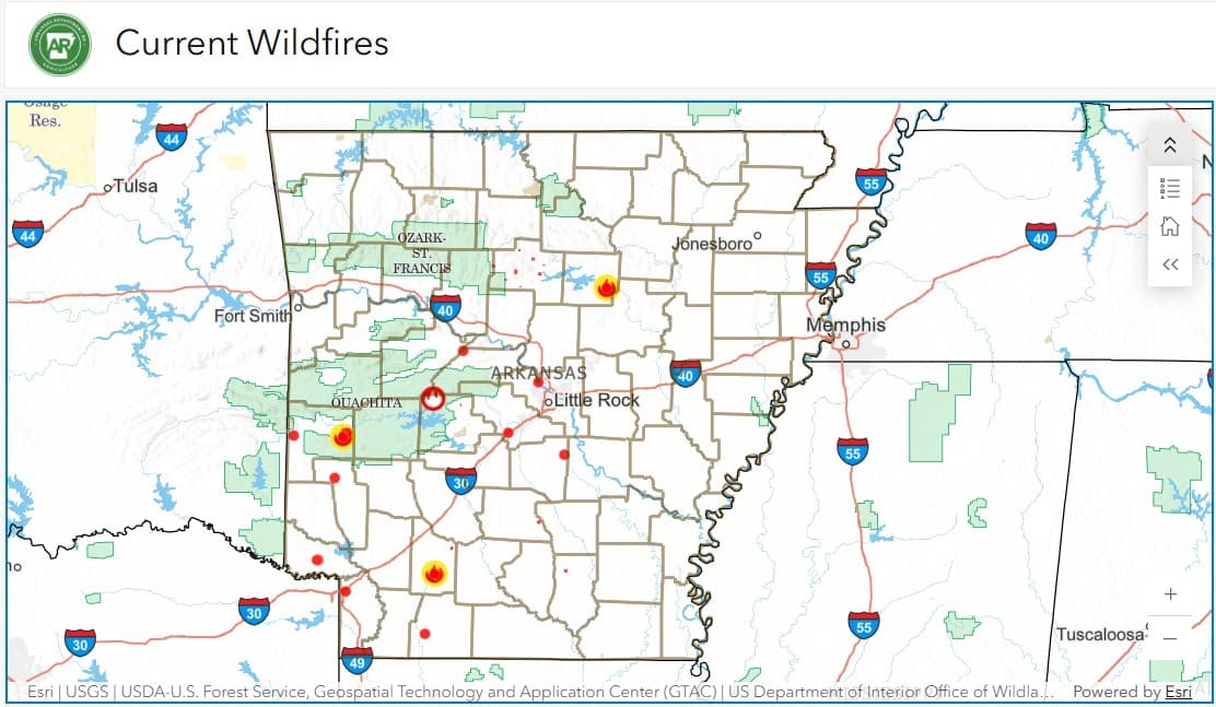
The Arkansas Department of Agriculture has introduced a real-time online dashboard to help residents monitor wildfire activity and fire risk levels statewide.
The dashboard provides detailed information, including total wildfire incidents, acres affected, and the general locations of active fires. According to a departmental statement, the tool is intended to enhance public awareness and deliver accurate, timely data during times of elevated wildfire risk.
As of Tuesday, Aug. 18, state officials have identified 25 Arkansas counties as being at a high risk for wildfires, while the remaining counties, including much of Northeast Arkansas, are categorized as having a moderate risk. Burn bans are currently in effect for 67 of the state’s 75 counties.
The department has warned that the fire risk across Arkansas is expected to rise in the weeks to come. Officials remind residents to stay informed by regularly checking the wildfire dashboard and adhering to safety recommendations.
The county-by-county wildfire map is available through the Arkansas Department of Agriculture's website, and updates can also be accessed through the agency's social media channels.